| Tropical Weather Discussion
NWS National Hurricane Center Miami FL
Tropical Weather Discussion for North America, Central America
Gulf of America, Caribbean Sea, northern sections of South
America, and Atlantic Ocean to the African coast from the
Equator to 31N. The following information is based on satellite
imagery, weather observations, radar and meteorological analysis.
...SPECIAL FEATURES...
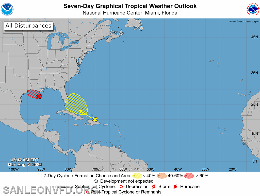
Northern Gulf of America (AL97): An area of low pressure (Invest
AL97) is near 27N90W over the northern Gulf of America, located
more than 85 nm south of the coast of southern Louisiana. Numerous
moderate to isolated strong convection is present north of 26N and
between 88W and 92W. Earlier satellite wind data indicated that
the circulation has not become much better defined from yesterday
while producing 25 to 30 kt winds. Regardless, additional development
is anticipated as the low moves slowly west-northwestward, and a
short-lived tropical depression or tropical storm is likely to
form before the system reaches the Upper Texas or southwestern
Louisiana coasts by tonight or Tuesday morning. Interests along
the southwest Louisiana and Upper Texas coasts should monitor the
progress of this system, as tropical storm watches or warnings
could be required for portions of the area later today. Regardless
of development, this system is expected to bring locally heavy
rainfall to portions of the Upper Texas and southwestern Louisiana
coasts during the next several days. An Air Force Reserve
reconnaissance aircraft is scheduled to investigate the system
later this morning. This system has a high chance of tropical
cyclone formation through 7 days.
Please, refer to the HIGH SEAS FORECAST issued by the National
Hurricane Center at website -
https://www.nhc.noaa.gov/text/MIAHSFAT2.shtml and the latest NHC
Tropical Weather Outlook at www.hurricanes.gov for more details. |